How to save 100 million dollars for a view
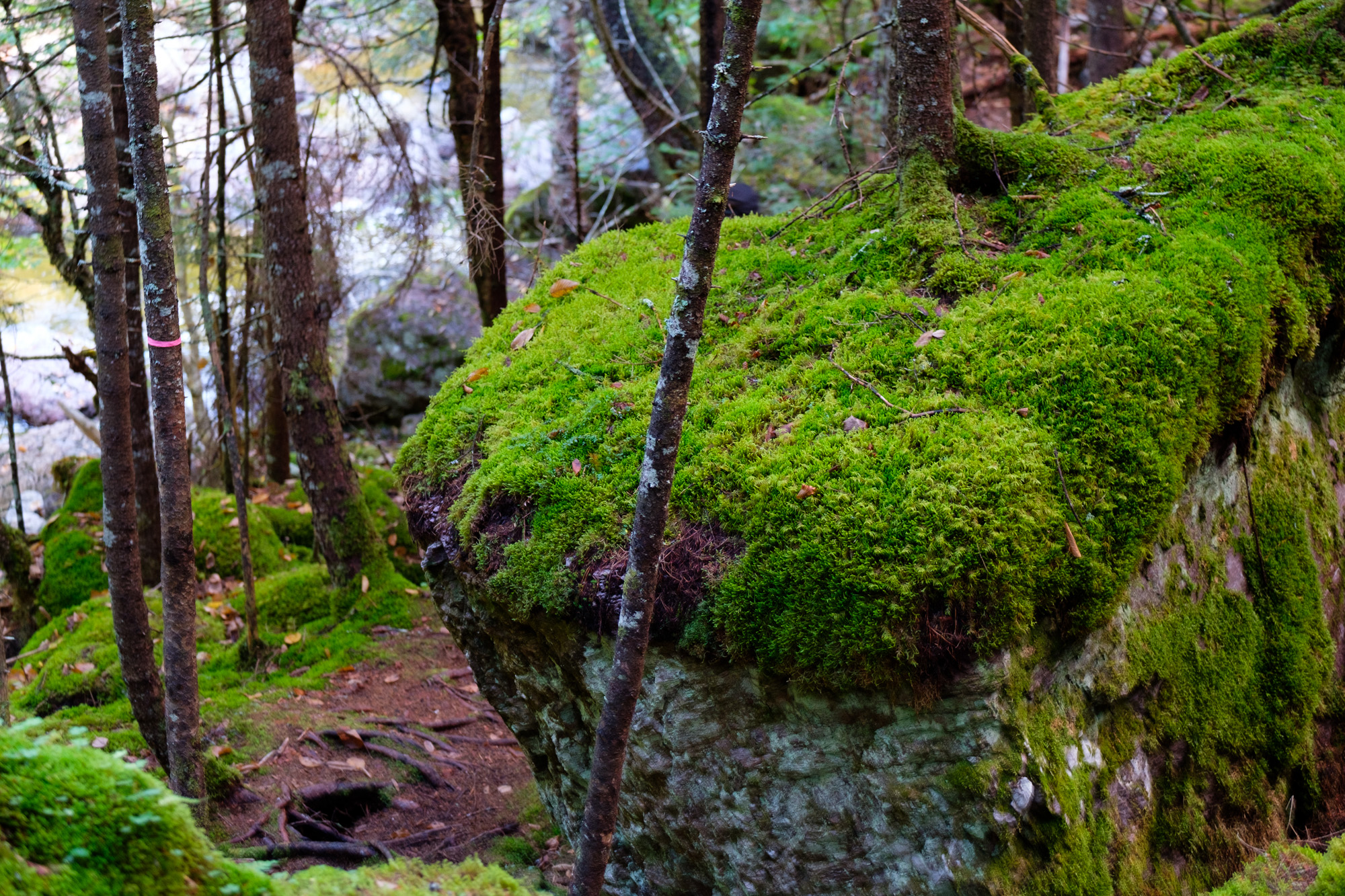
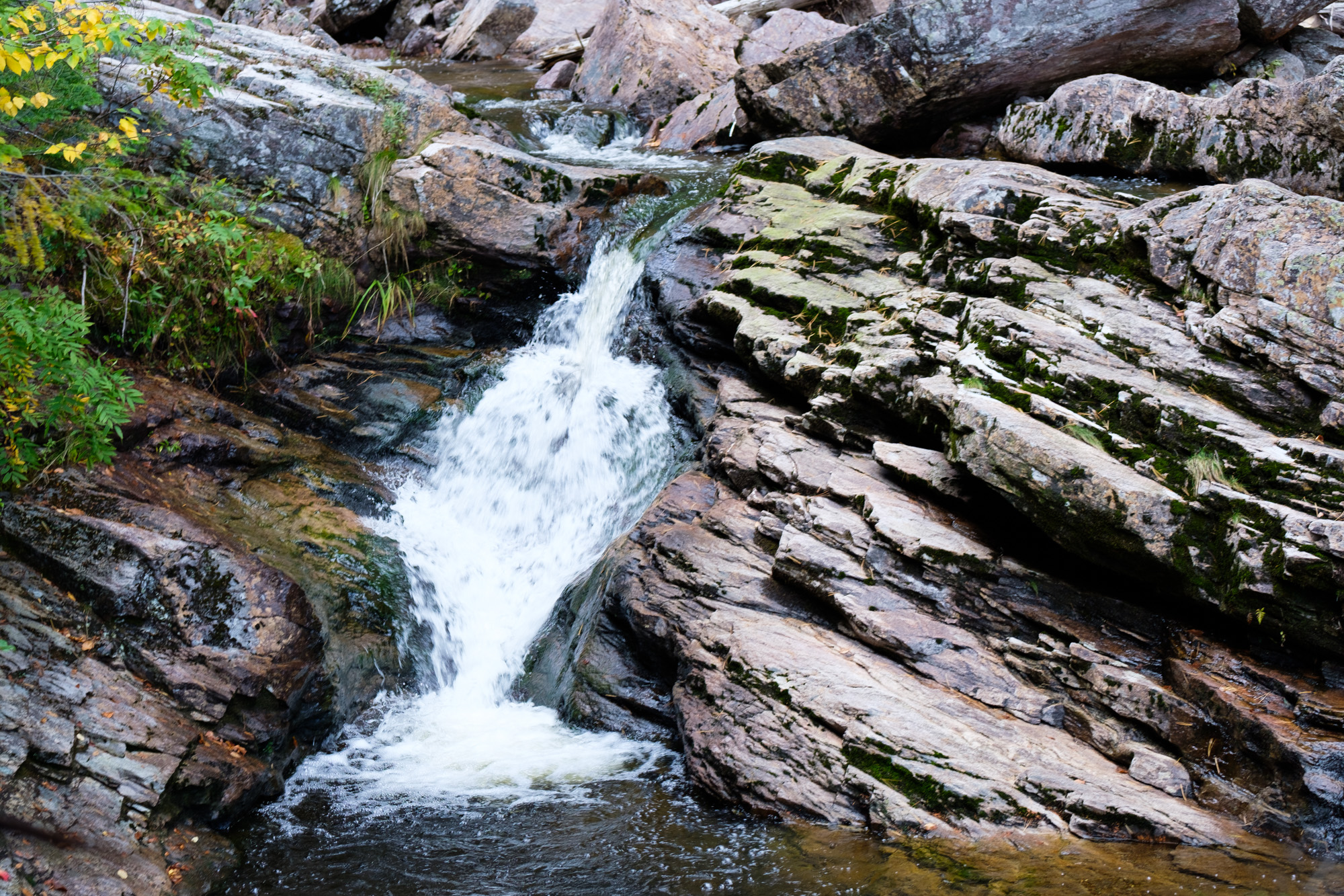
Walton Glen Gorge is a hidden gem of New Brunswick. Some go as far as calling it the "Grand Canyon of New Brunswick". Needless to say, it won't stay hidden long. A park is being built. You soon won't need hiking shoes no more. They even plan to fence the gorge "for your safety".
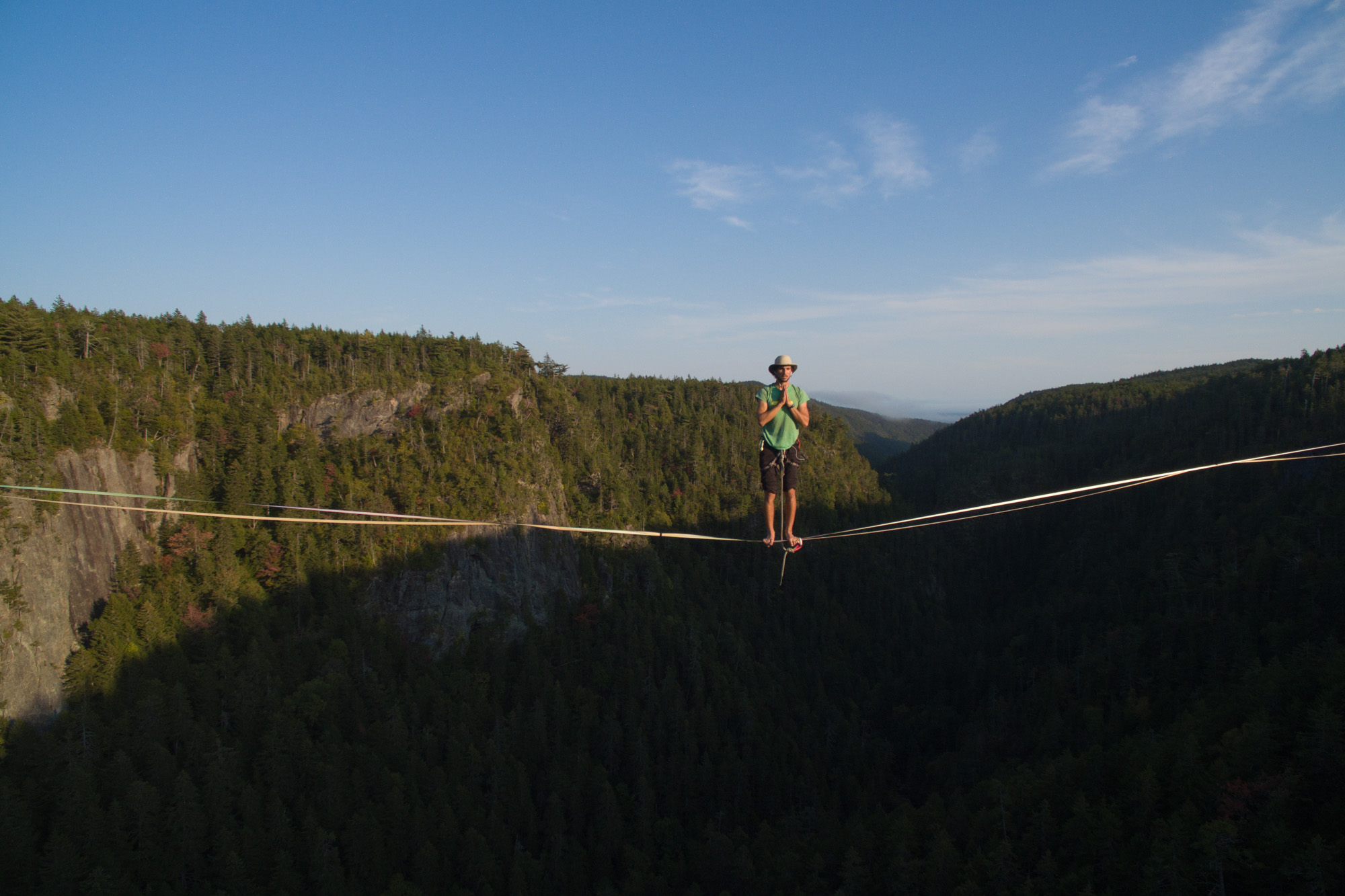
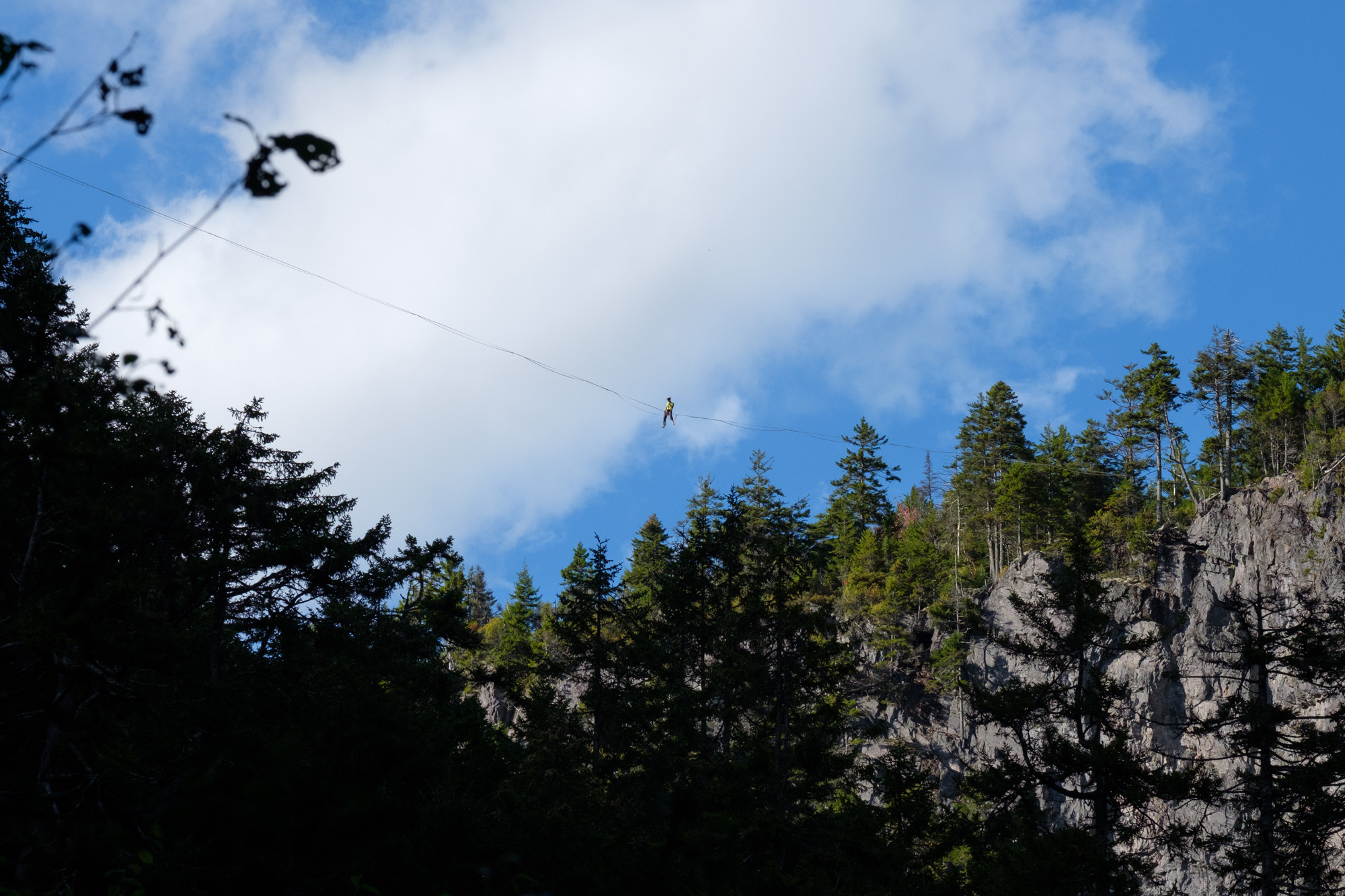
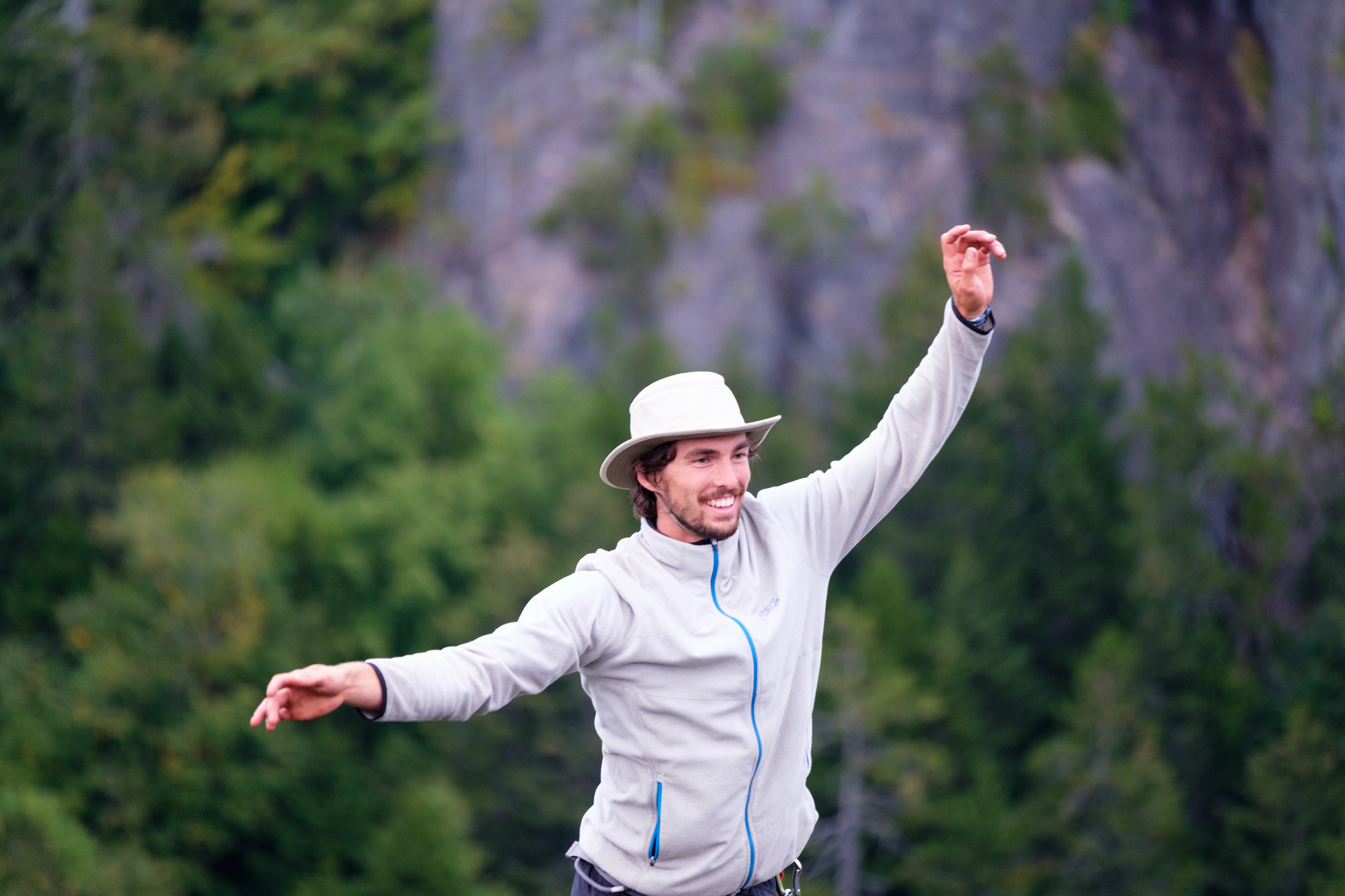
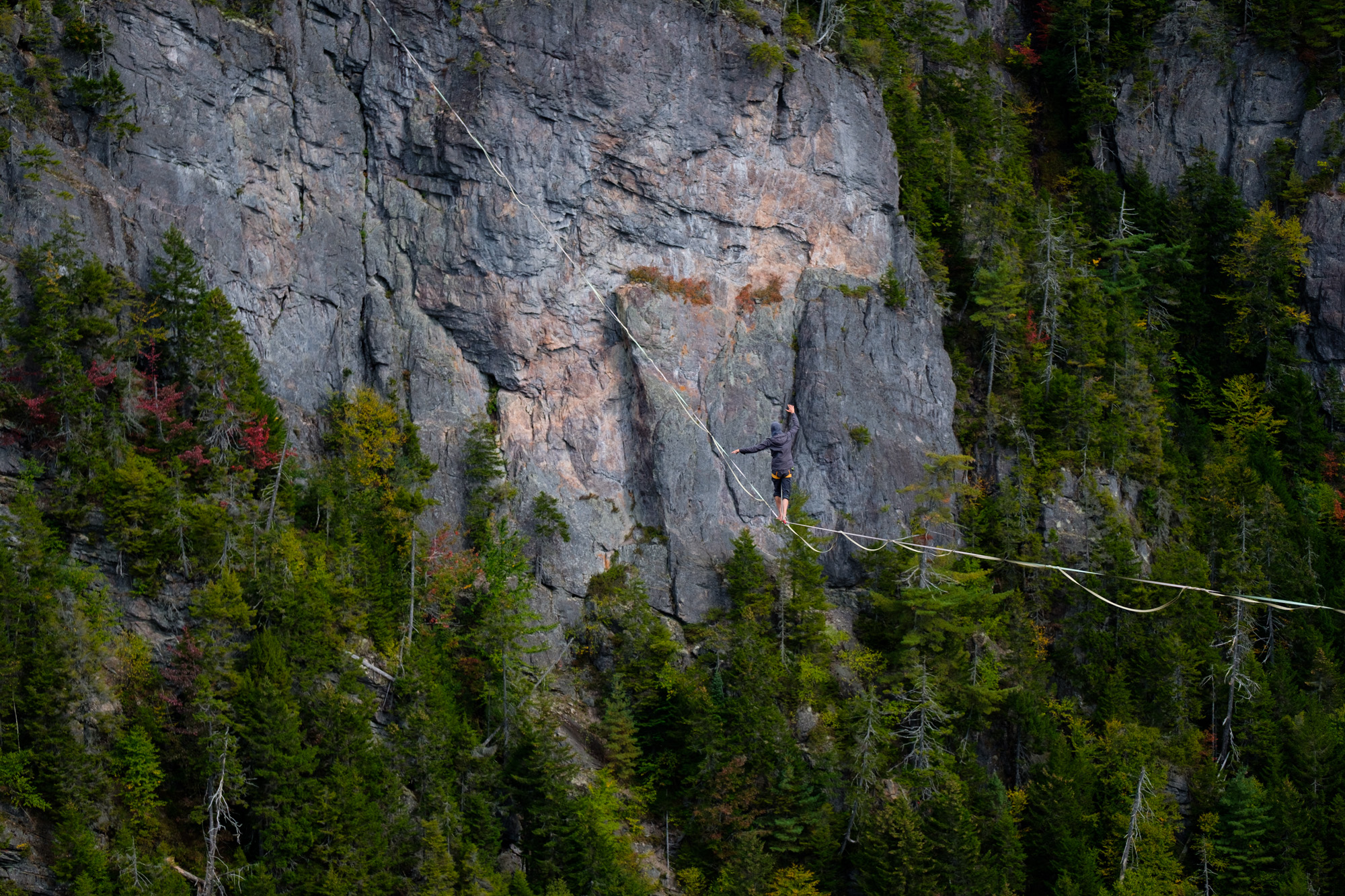
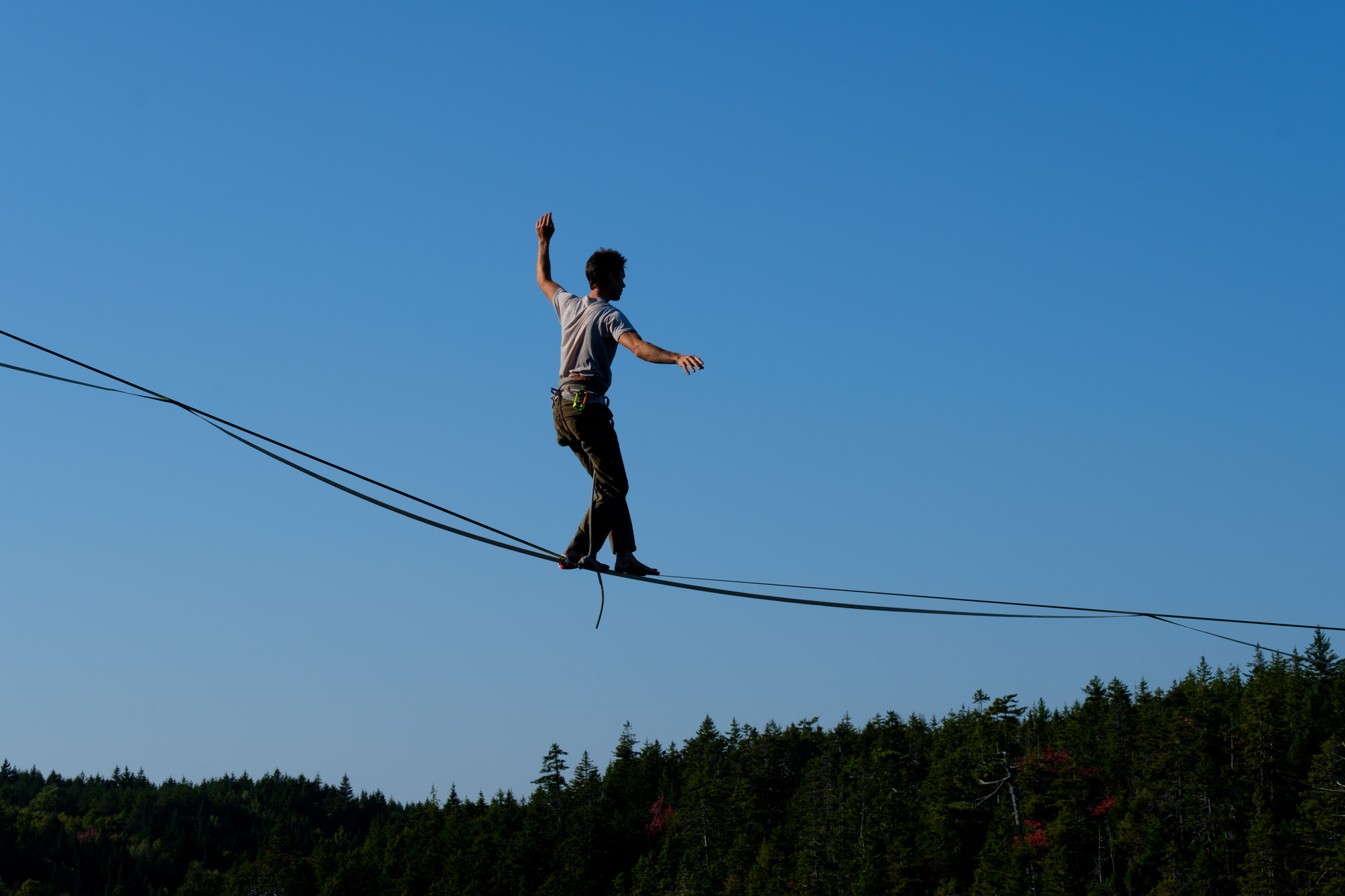
I just got back from a week there and it was an incredible experience: first time I participated in the establishment of a new line, first time I rigged and walked on a 200 meters line peaking at 100 meters, first time I spent a full week in the wild 2 hours away from the closest town. Thanks Caël, Renaud, JF and Sam for sharing this and making it possible.
If you don't care for all my blabbering and just want your dose of visual stimulation, click here for my photo album and here for JF's. Otherwise, let's get walking, 200 meters is a long way!
The rigging
Renaud and I left Montreal on a Sunday at 7 am and picked up JF close to Trois-Rivères. After about 8 hours of driving, we arrived at Walton Glen. Caël and Sam where already in New Brunswick so we met at the last GPS-able spot before getting off-road. Since it was already dark when we got at the gorge, we set up camp and decided to rig the line the next day.

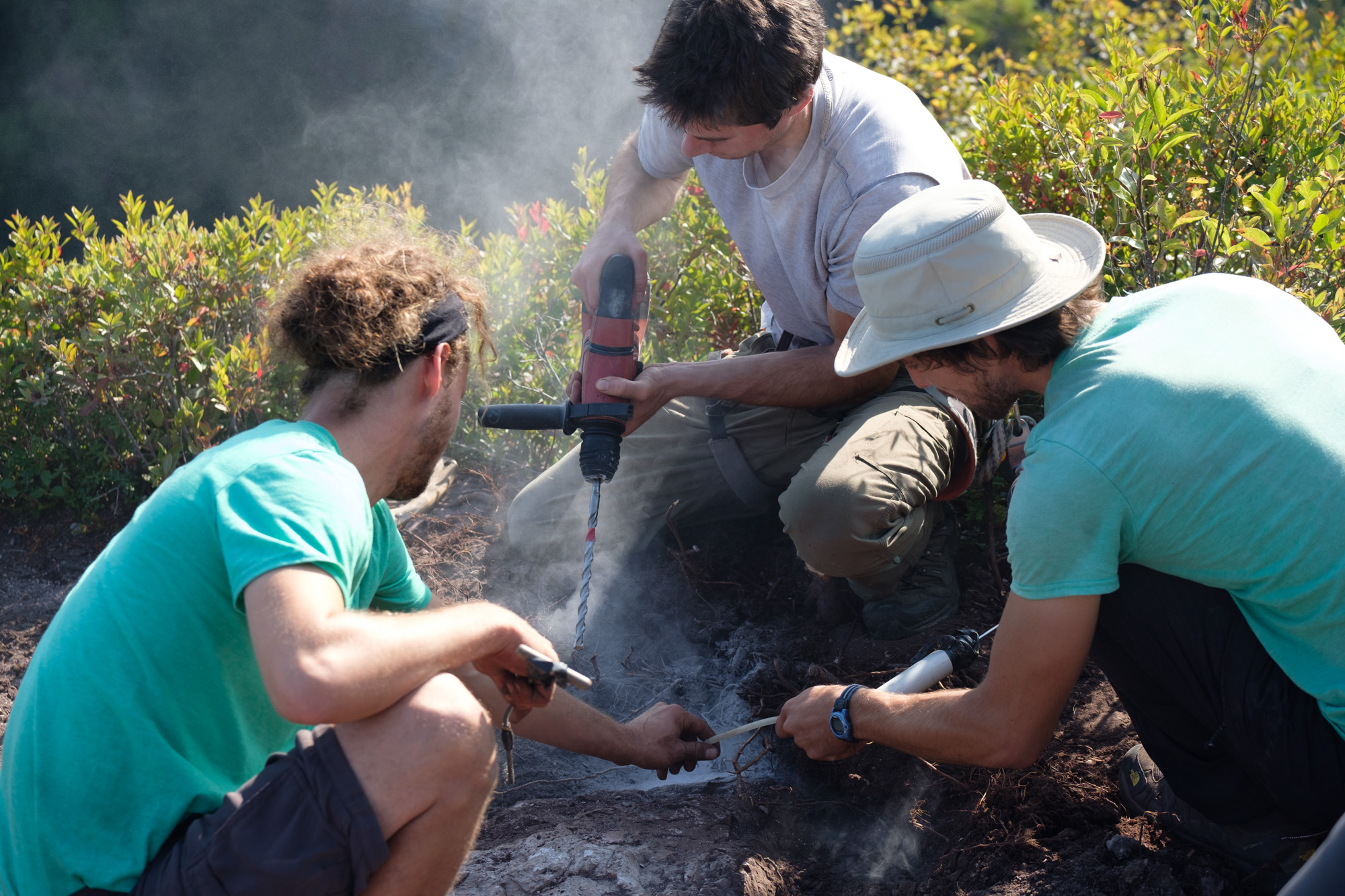
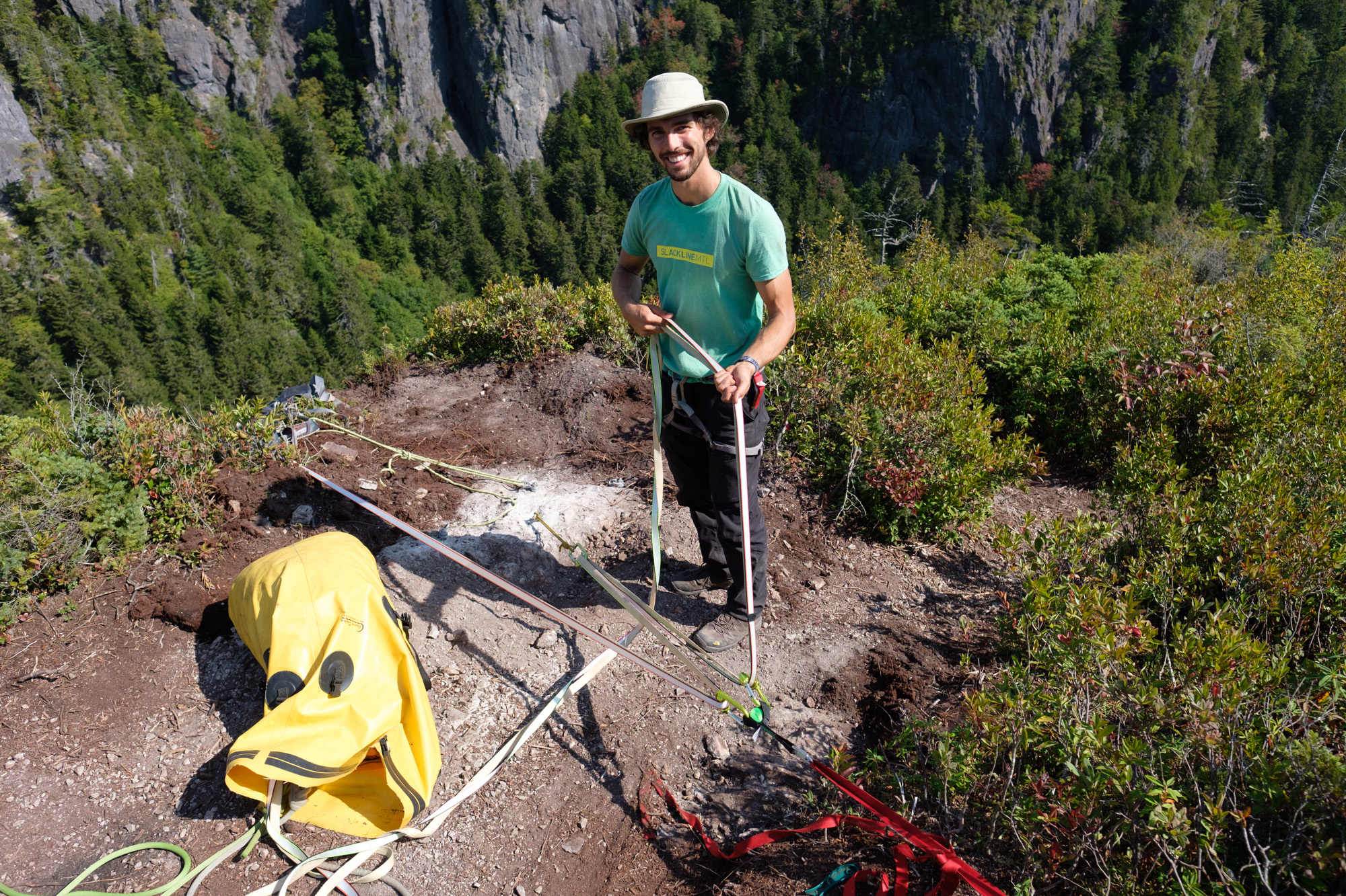
We started by adding 4 bolts in the rock. Everyone was pretty excited about this part of the project since drilling is not something we get to do often. The rock was on the soft side and a little brittle but strong enough. The most difficult part of bolting is selecting the right place. It must be safe yet unobtrusive. To be honest, it is challenging to be certain of the boulder we picked. In an ideal world, you want to have a good look at it, where it starts, how big it is. But when it is covered with soil it is tricky. To be extra safe we bolted probably 4 or 5 feet from the edge. We used mechanical bolts but ideally, we should have used glue-ins. We also didn't realize we were that close to the ocean, so titanium might have been better than stainless steel.
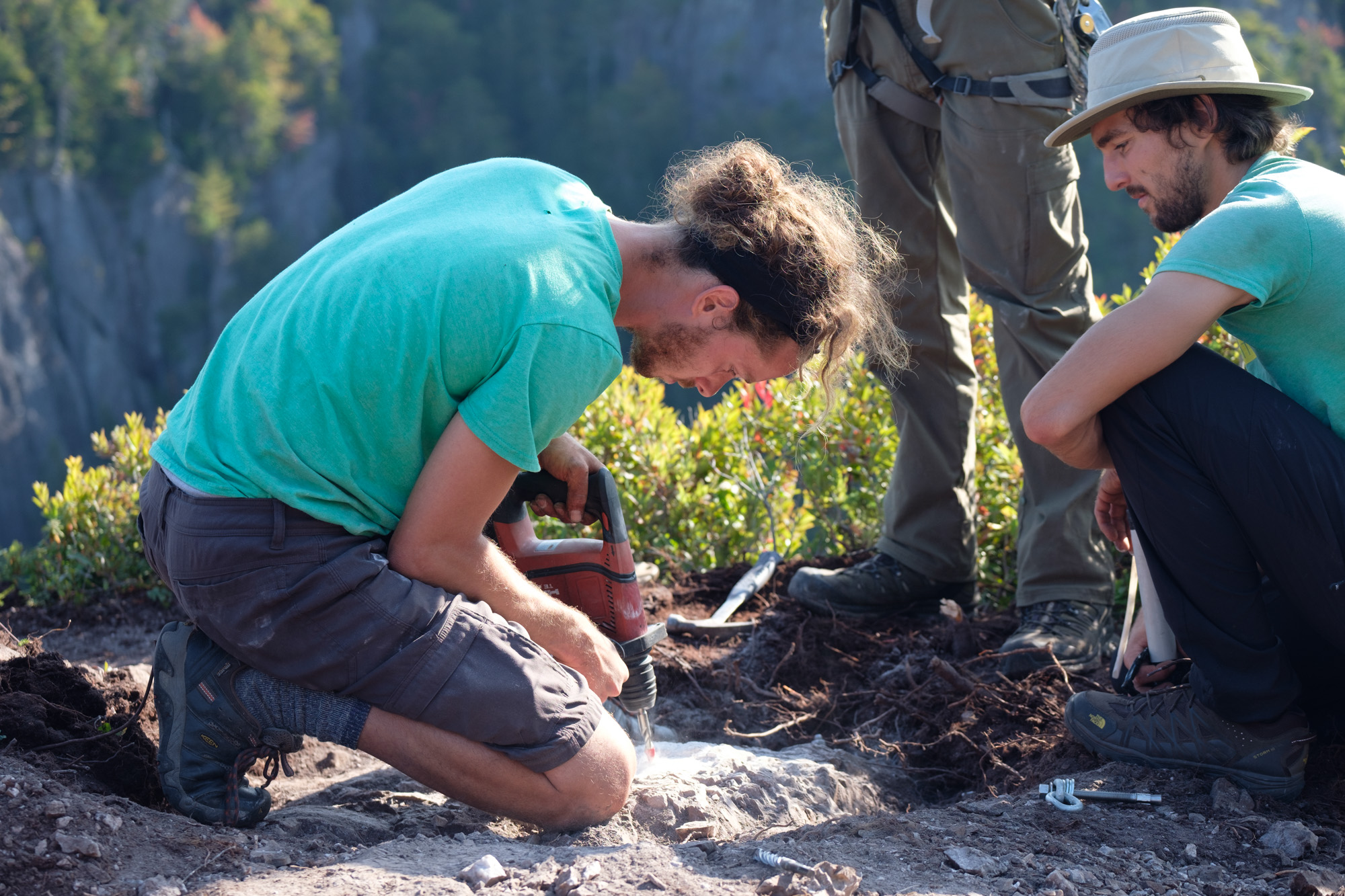
The Bolting Bible is a decent starting point to learn more about bolting. Though it won't replace experience or teach you common sense which are arguably the most important skills.
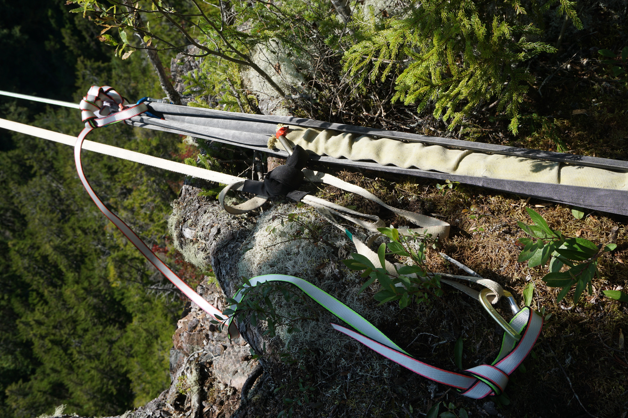
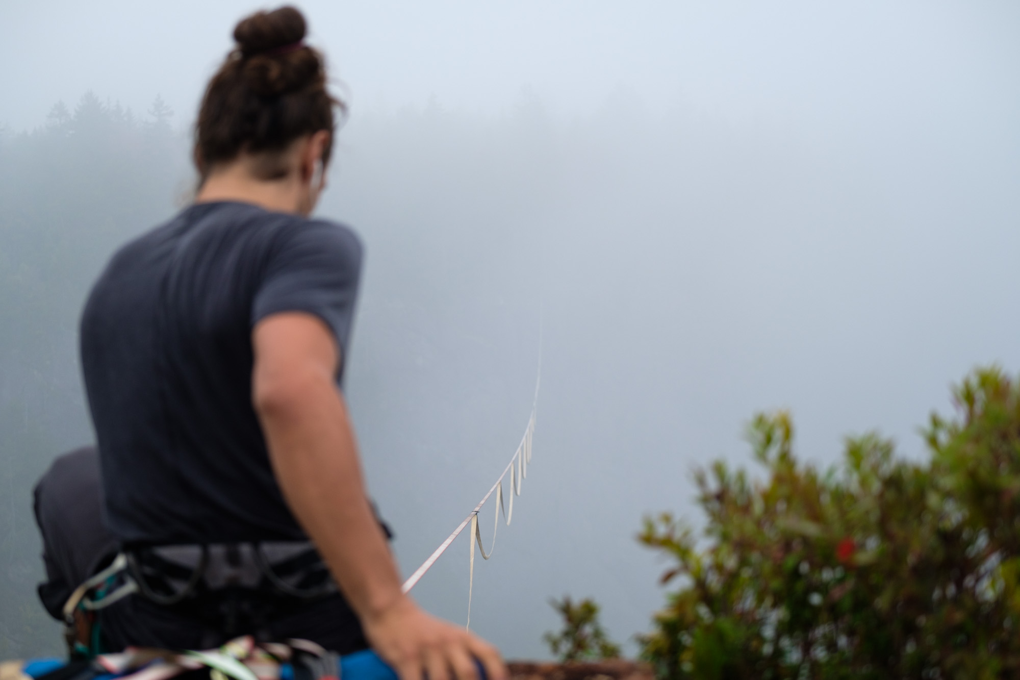
Regarding the anchors, the static side consisted of a BFK on 3 trees with a spanset extension. We used a steel carabiner rated at 45kN. I would have preferred a shackle but that's ok. The tensioning side had a sliding-x with amsteel whoopy slings as a backup.
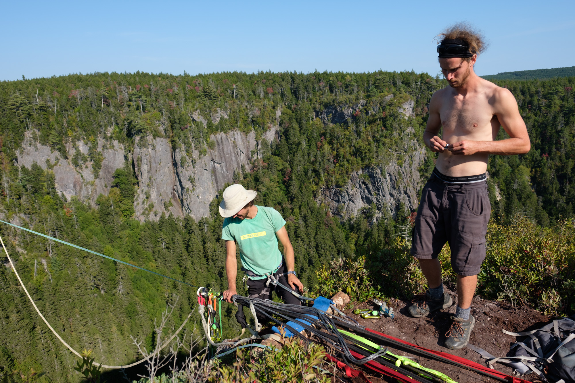
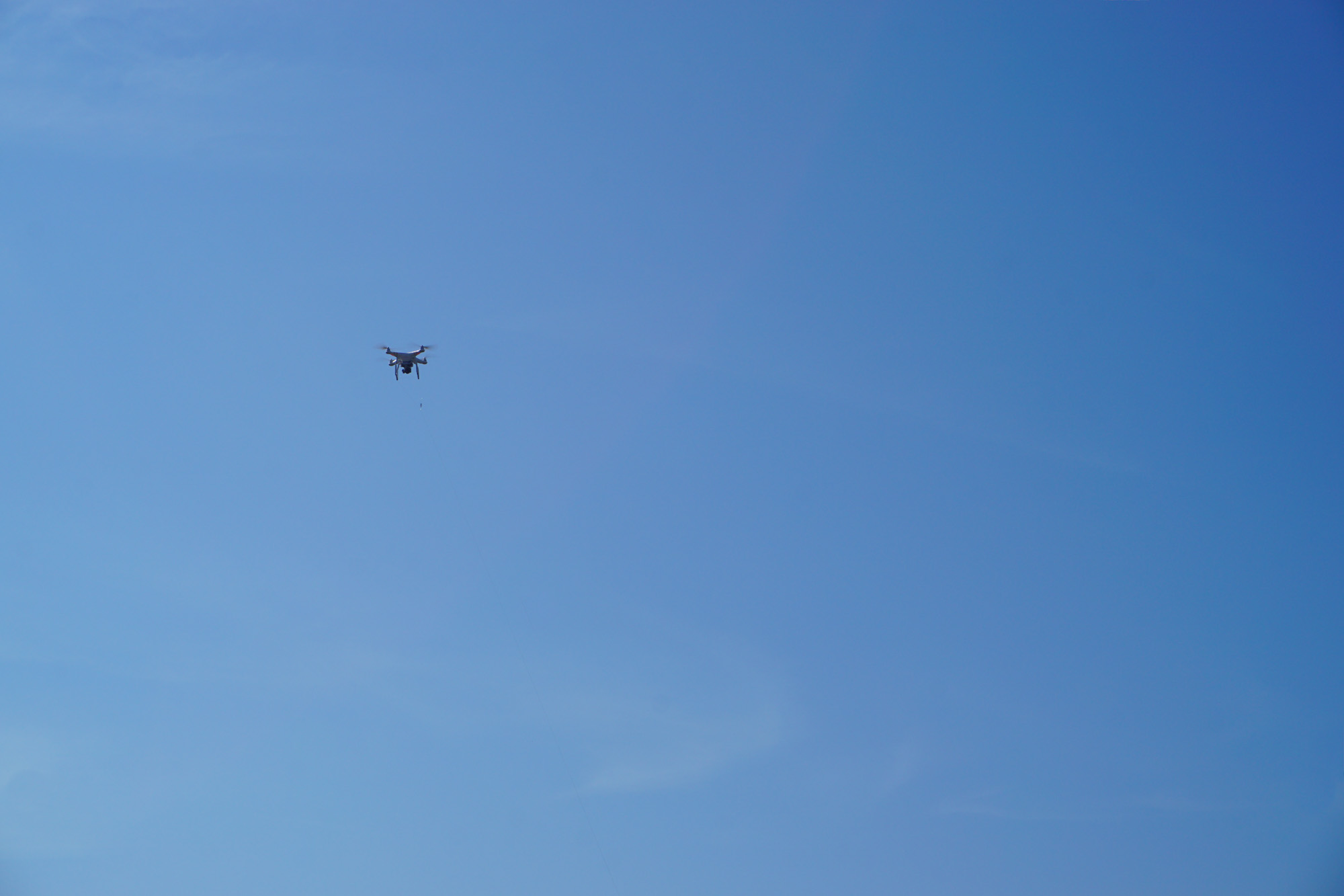
Next, we passed the line. We flew a drone attached to a fishing rod. We ran out of fishing line and had to extend it mid-flight. And after 180m, I lost visual connection so I had to land it at sight following JF's instructions on the other side. If you've ever flown a drone, you know that landing a drone by sight 200 meters away on a cliff edge with about a square meter of space is stupidly risky. And now you know why flying a drone to pass a line is always the most stressful part of the rig. Thankfully it turned out well and we could pass the paracord across followed by Caël's brand new Unicorn webbing (on Spider Silk).
In the end, the rig was safe but there are couple things we could have done better. It might not have been slackchat approved but it was fine with all 5 of us. And it was a good learning experience. Ok now let's walk for real!
One day, one send!
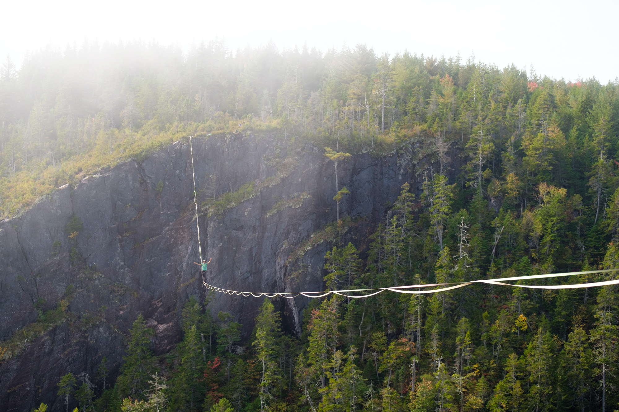
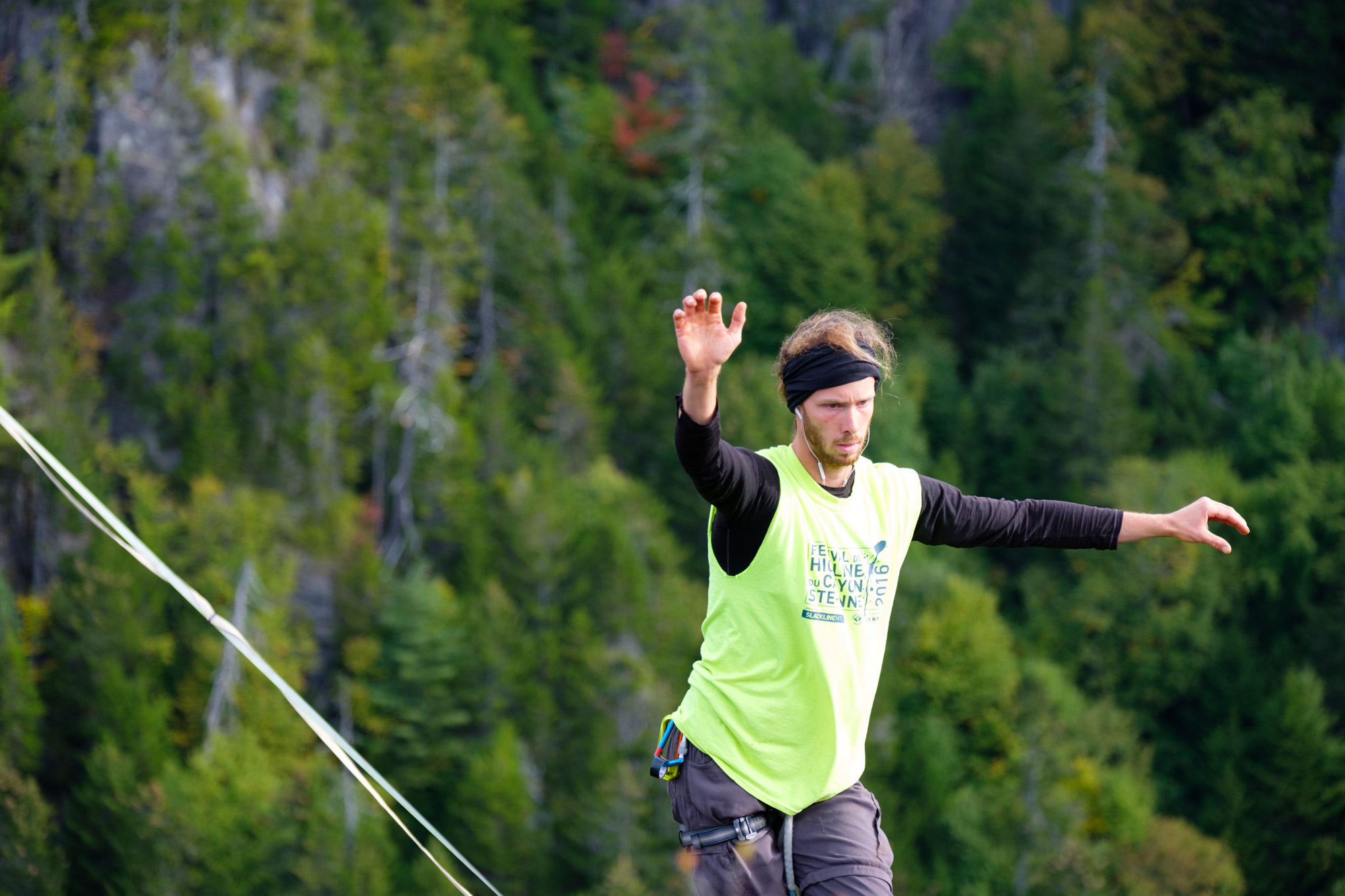
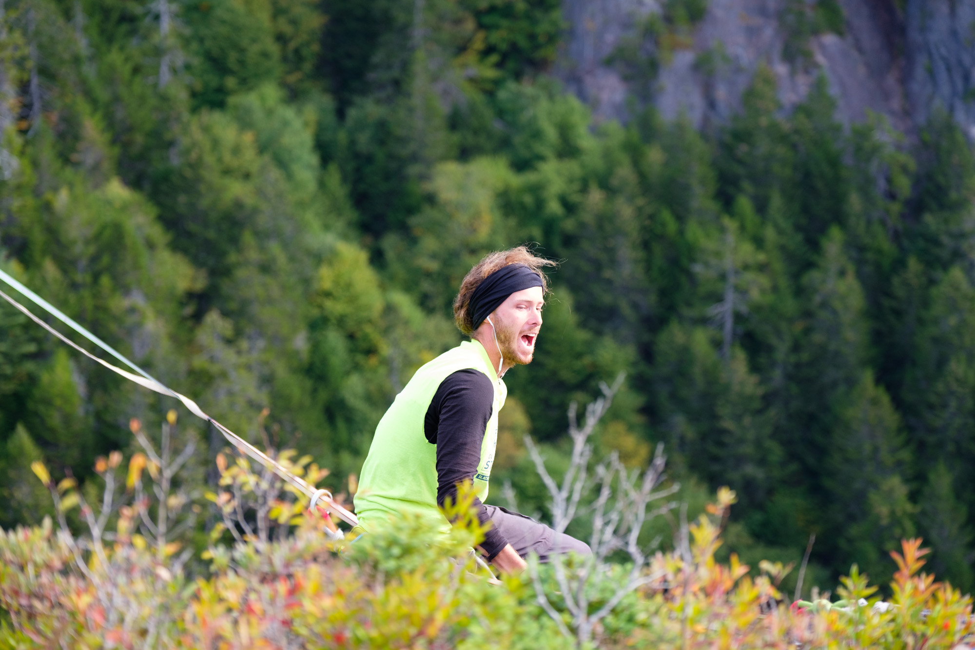
On Tuesday, we spent our day walking on the line, each getting familiar at our own pace. At the end of the day, Caël went for a golden hour session. As the light was nice, I started the drone and in one of those sessions where Caël makes it look super easy, stopping in the middle to make some exposure move and wave the camera, he ended up sending it. Inspiring!
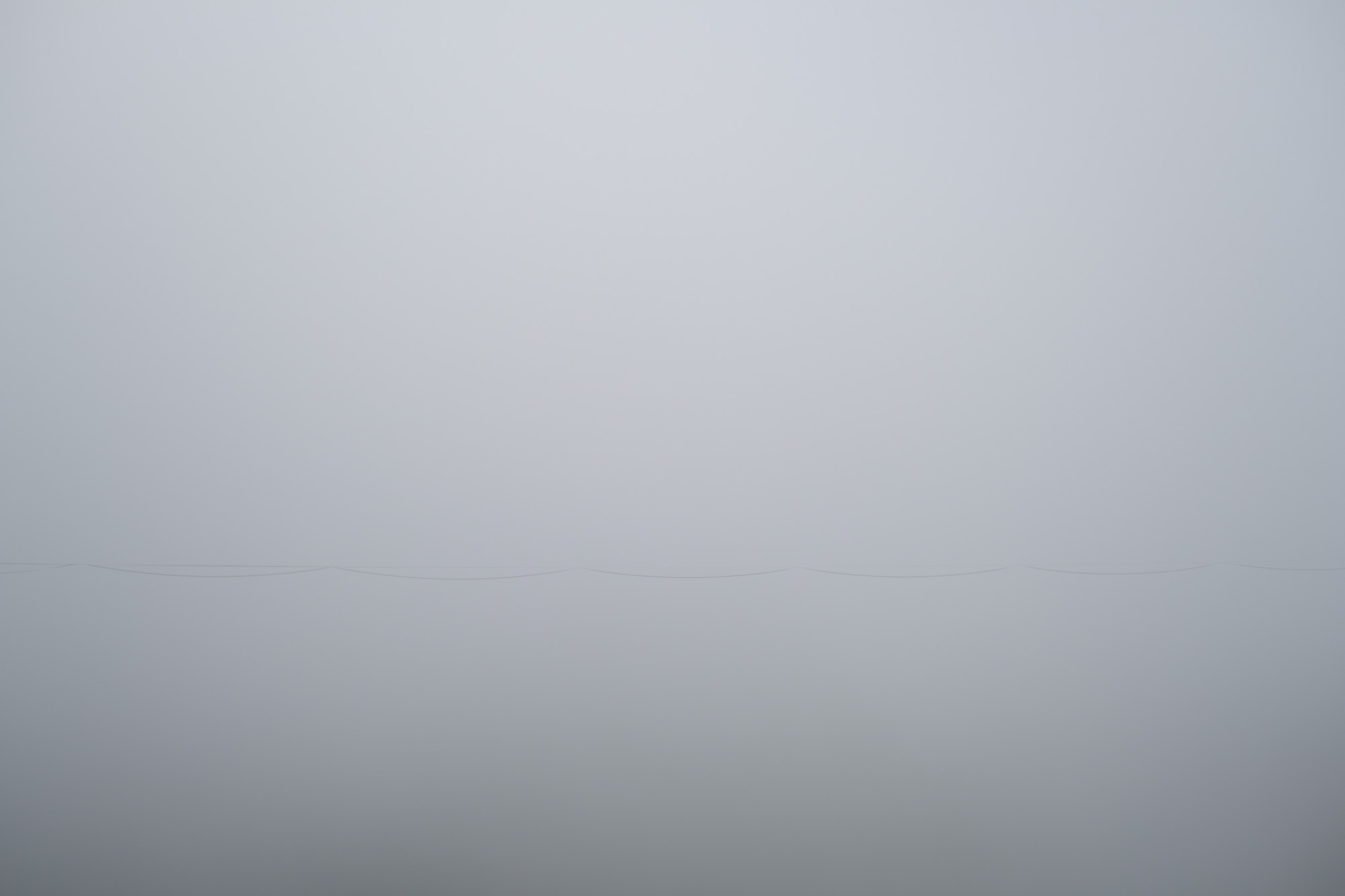
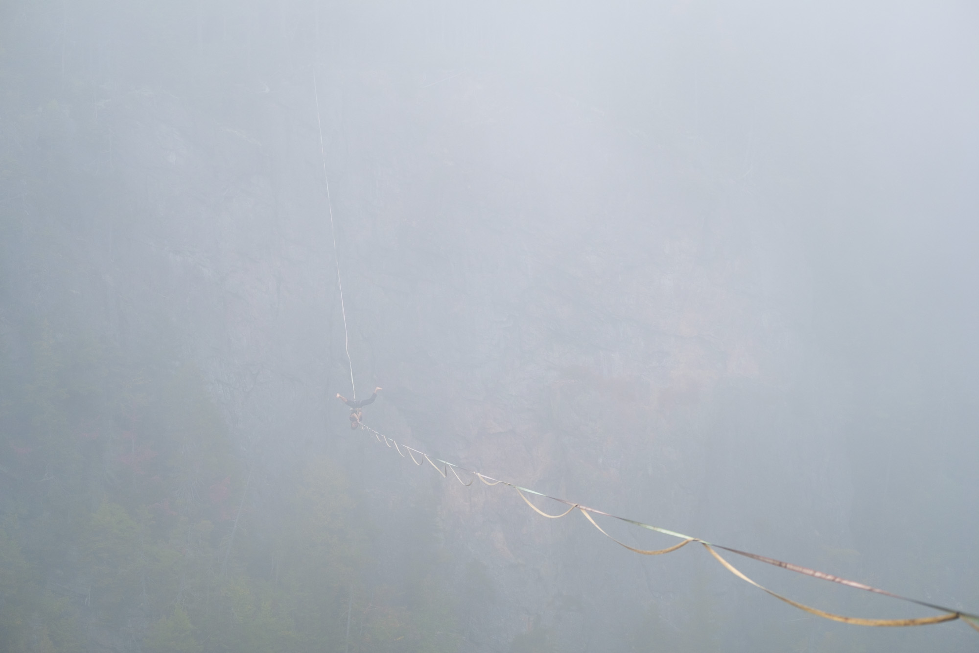
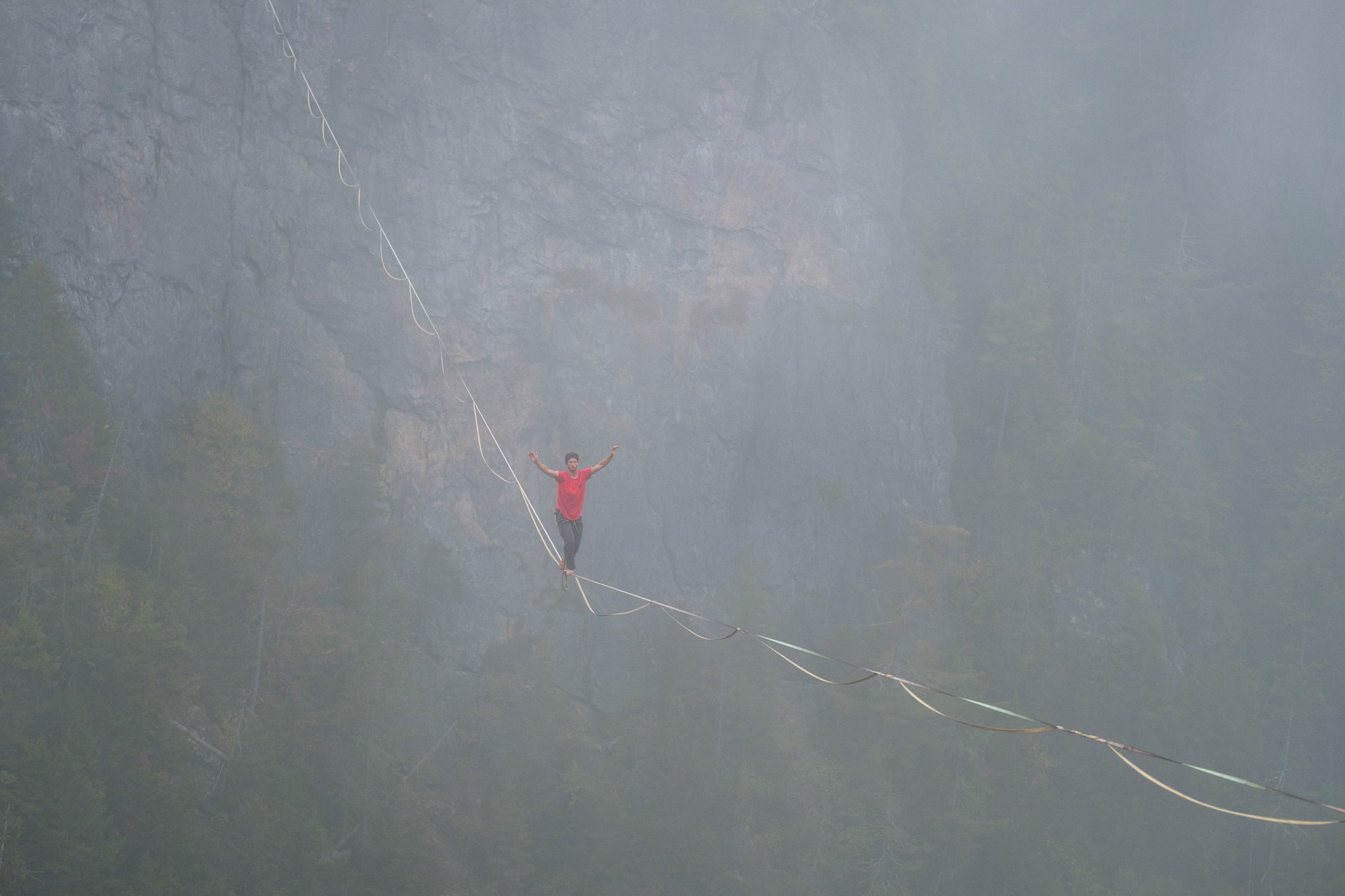
From white to black
On Wednesday, we woke up to a very foggy day. At some point, we didn't even see the other side of the line. It was really trippy to walk the line with clouds slowly moving all around you.
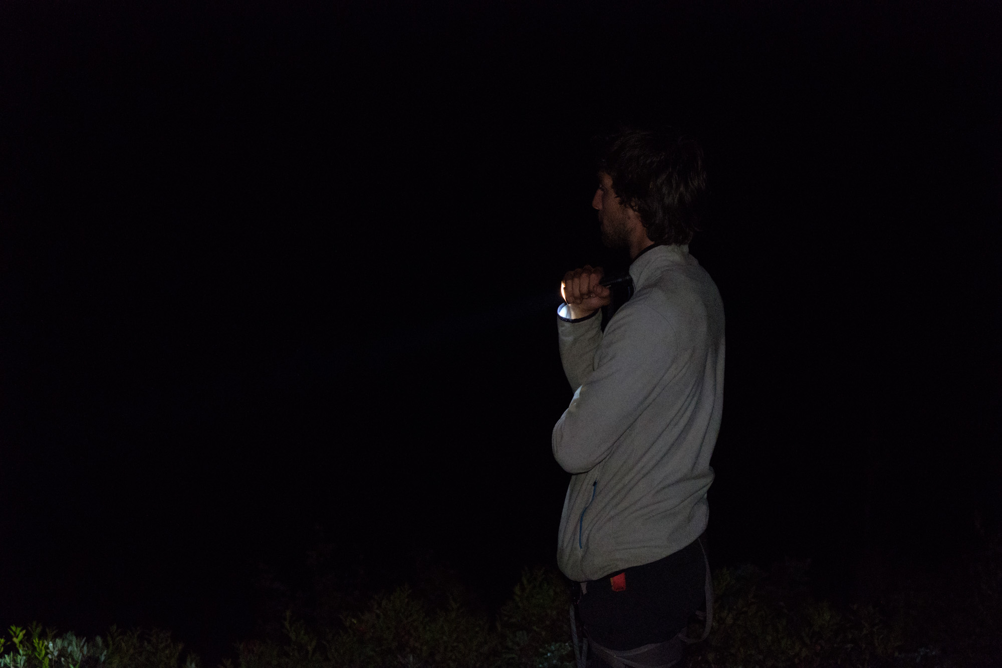
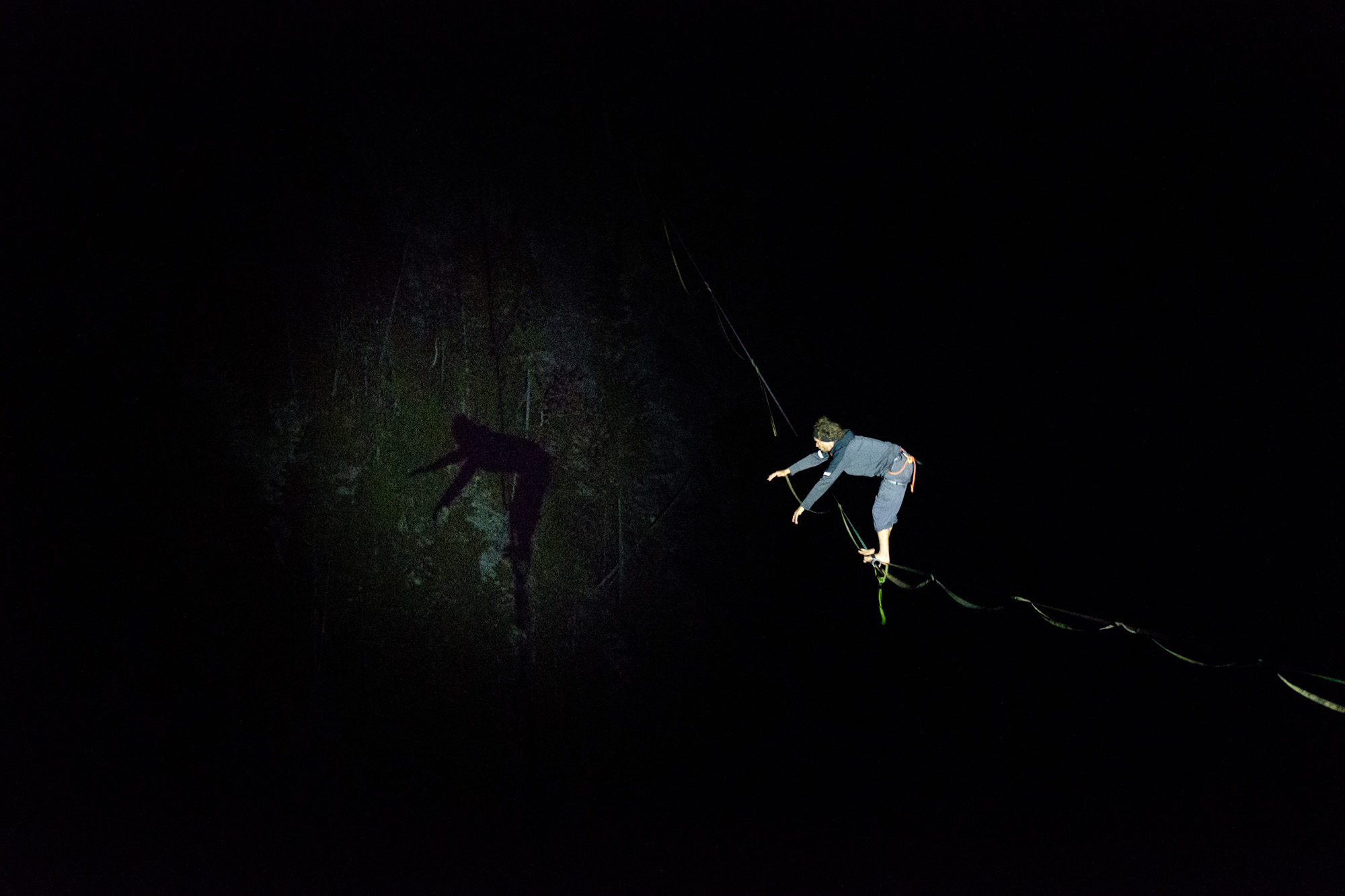
It was a cloudy day so when the sun set, it turned pitch black. We took a powerful flashlight out, sent Renaud and Caël on the line and started having fun with their shadows on the fog and the cliff edge. This too was pretty trippy!


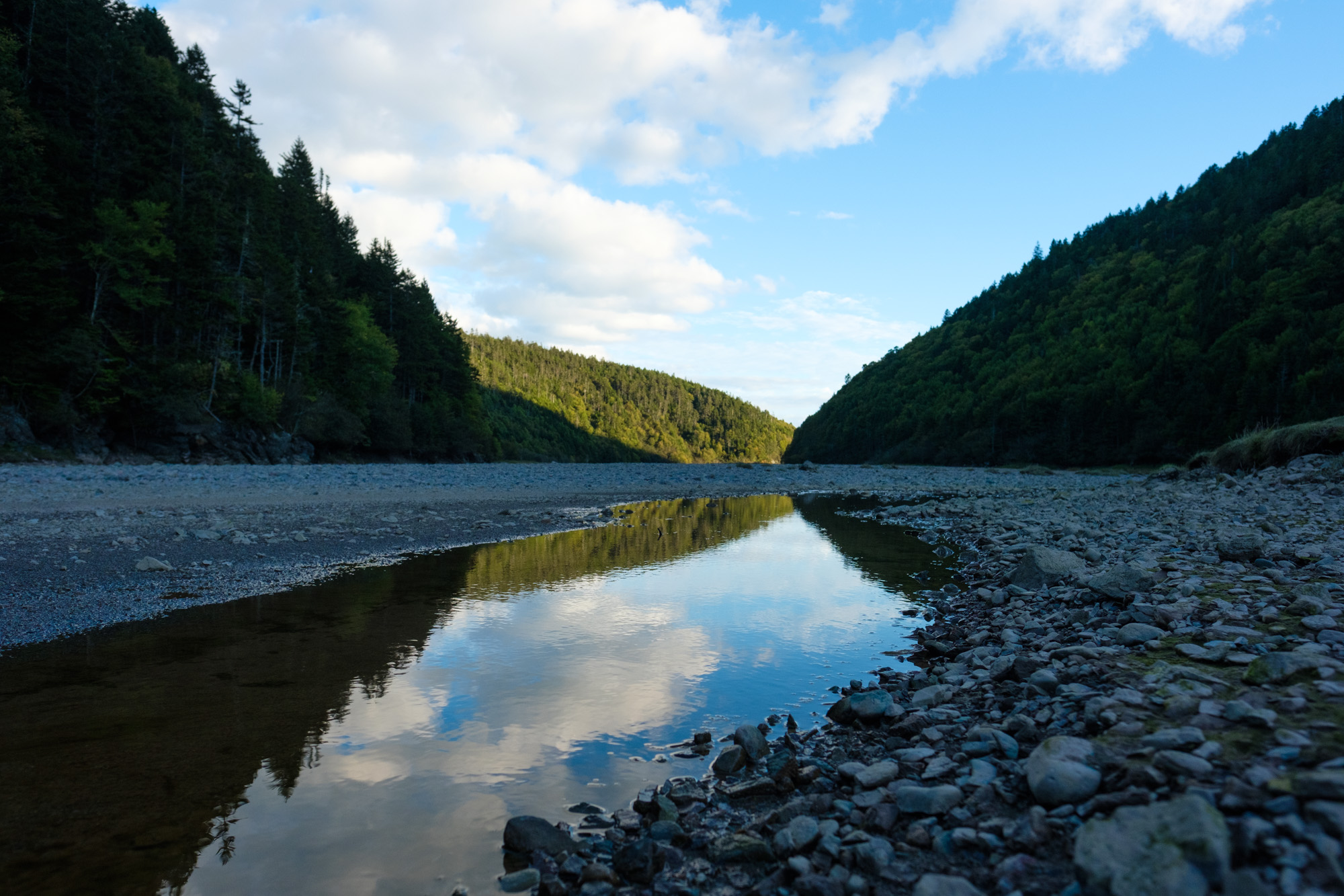
Where the river meets the sea
Thursday was pretty windy but still warm. While Caël and Renaud stayed to slackline, JF and I decided to walk to the sea from the camp. It is a nice adventure. We followed a trail by the side of the river. We could still occasionally see the line. After about 45 minutes we reached the famous Eye of the Needle, which is basically two cliff edges with water in the middle. There is no way to pass it without walking with water up to the chest. I was too busy carrying my backpack overhead and making sure my camera didn't get wet that I totally forgot to take a picture. But a google search will show you what it looks like. And if you're wondering, it was cold! But not the coldest swim of the day!

After that little bath, we followed the river. It looked less and less like a trail at this point. We had to cross the river couple times and first tried to keep our shoes dry. I survived walking barefoot on the rocks for some time while JF was methodically avoiding the water. Then my feet started hurting and JF's method wasn't the fastest. As sunset was getting close, we put our shoes back on and stopped caring for the cold water.
That sped things up quite a bit and we managed to get to the sea before dark. There was one last obstacle to the beach front, 30 meters of freezing cold water. On JF's lead, we dove in the water and went for a quick walk on the beach. It was worth it! We walked our way back at the light of our headlamps, which made crossing the Eye of the Needle a lot nicer experience. The light was bouncing off the water creating nice reflections. It ended up taking us 4 hours to walk approximately 10km.

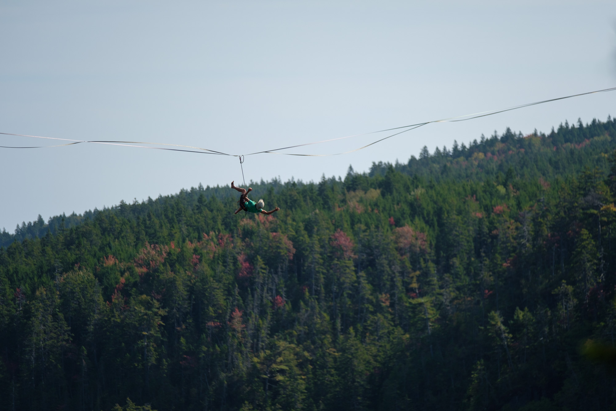
Another send and a full-man later
Caël might not have been satisfied with his send, so he decided to "full-man" the line (walking back and forth without falling). The next day, Renaud and Caël had some fun doing a tandem. On the last day, Renaud also sent the line under the eyes of a small crowd of curious hikers. Saturday also ended up being my best session of the trip.

That's it for the story of our week in New Brunswick. The rest of the article is more informational. To see all the pictures, click here for my photo album and here for JF's.
A lesson about Crown Land
I learned about Crown Land for the first time on this trip. I find interesting to know how land ownership and distribution works. In Quebec, almost all accessible land (aka drivable within couple hours) seems to be privately owned. It makes highlining tricky because we need to get proper authorization (or hope to get away with it). It wasn't the case at Walton Glen, we could do our thing without asking. We talked with a lot of people who came to see what we were doing, including managers of the Fundy Trail, head of the new road/Park construction and the cops. No one ever cared that we drilled the rock, that we were conducting an "extreme" activity or that we had a camp.
Crown Land is basically everything (including water) that is not privately owned. It represents 48% of New Brunswick. Most occasional use of Crown Land doesn't require formal authorization. This includes hiking, biking, picnicking, geocaching, canoeing, overnight camping and now highlining. The important part is "occasional". For extended use, like campsites, Right of way or commercial use, you need formal authorization. You need to submit an application that will be reviewed. That's basically what's happening at Walton Glen, there is a private development of couple roads and a Park to develop tourism (more about that in the next section). Once a special authorization is granted, the rules can change and access can become restricted, like for National Parks.
If this picks your curiosity, there is a map of New Brunswick's Crown Land.
The development of Walton Glen
Now that we are done with the fun part, I wanted to share something that kept us talking quite a bit during the week. The least we can say is that the development around Walton Glen Gorge doesn't make all the locals happy. The (shitty) road that was rebuilt is now gated and might become paying. The area surrounding the gorge went from wild to drivable and they even consider building a floating platform 8 meters above the gorge for tourists to see the Fundy Bay; platform that would be on a currently protected natural area.
The main issue, which after some research is pretty common, is that they are gating access to Crown Land which is public. It removes access to people who've been coming here for years. When we were there, the gate had been cut open, which is why we could have access with the car but the rest of the time it was close. As much as accessing the land is legal, cutting a lock is not.
I don't want to make this post political. I'm thankful for the roads that saved us hours of walking with all the heavy camping and highlining gear (it's hardly if we didn't drive the car to the cliff edge...). I can see why they'd want to make this beautiful spot accessible but I also understand that when you have such beautiful wilderness, you'd want to keep the humans away. If you are reading this from Québec, Canyon St-Anne is a perfect example of what it will likely become: unpleasantly touristy.
The development of the area is a 100 million dollars project. That's why the line was named "How to save a 100 million dollars for a view".